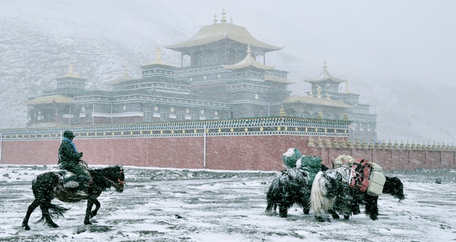
Review: Tea Horse Road by Michael Freeman and Selena Ahmed

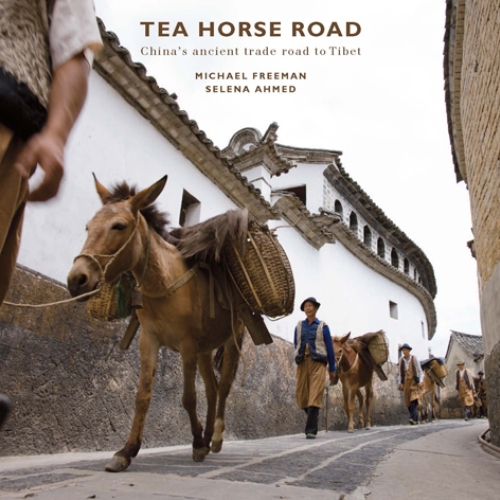
Review: Tea Horse Road by Michael Freeman and Selena Ahmed

For many travelers, one of the difficult aspects of setting aside the time and money for a trip to China is that it’s hard to know what you’re getting yourself in for until you’re stepping off the plane — unlike buying a car there is no ‘test drive’ option.

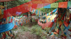
We frequently receive enquiries about our Tea Horse Road journey, an exploration of ancient trade routes in Yunnan from the jungles of Xishuangbanna to the breathtaking Tibetan highlands of Shangri-la.

For 13 centuries, the Tea and Horse Caravan Road was a network of rugged paths linking China with Tibet, Southeast Asia and India through Yunnan. Its name comes from the exchange of Chinese tea for Tibetan horses that formed the backbone of this commercial network connected by fearless caravans. These caravans facilitated the exchange of customs and culture between dozens of different ethnic groups scattered across some of Asia’s wildest terrain.

A virtual trip back in time peppered with some of Yunnan – and China’s – most spectacular scenery, our journey is led by Jeff Fuchs, the first Westerner to travel the entirety of the Tea Horse Road.

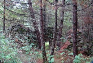
It is not easy to fully convey how special places such as Mangang Village or Shaxi are over the phone or in an email. Many places along the old route are simply too unique for words.

That’s why we were excited to happen upon the book Tea Horse Road, an amazing introduction to one of the world’s most beautiful and diverse regions. A joint effort between photographer Michael Freeman and ethnobotanist Selena Ahmed, this incredibly thorough book is the result of years of travel, photography and research.

This attractive 340-page book published by River Books is big enough and has enough photos (more than 270!) to call a “coffee table book”, but that wouldn’t do it justice.

Freeman, who makes great photography seem easy, spent two years on the route getting to know the places and people of the old route through his lens.

Ahmed’s writing – which comes from four years of doctoral research – allows the reader to understand the route as a whole while appreciating the unique role each individual town or ethnic group played within this fascinating trade network.

This September we will travel the Tea Horse Road once again with the incomparable Jeff Fuchs. If you are considering joining us on this unforgettable journey, we highly recommend that you give it a test drive with Freeman and Ahmed’s excellent book.

Ghosts and ‘Ka’ (Snow)

The following is an excerpt from Jeff Fuchs’ Tea and Mountain Journals, a blog by explorer, photographer and writer Jeff Fuchs.  Jeff is the 2011 recipient of AsiaTravel’s Explorer Grant.  He and friend Michael Kleinwort are currently traveling through unknown portions of the Tsalam route in Qinghai.

Below is an update from their journey…

———-
We are hunting a ghost, ghosts in fact it seems. The Salt Route that hasn’t been documented, this Tsalam that I have dreamt about and that we now seek is becoming akin to chasing vapours, or trying to track windblown sand. My western notion of a ‘route’, the idea of one single ‘route’ being the Salt Road has been annihilated. I should have known better than to assume any one path, road or route can be omnipotent upon the mighty Tibetan Plateau. The essence (which I’ve temporarily lost sight of) of a “route”, especially a trade route through these motionless and giant spaces is made up of many various paths that join, stretch and then veer off from one another. A route here at least, is the sum of its parts, and its parts are fragmented trails, not a single path. A route may have a name but it inevitably has many feeders that contribute – and the route of salt is true to this.
Lower Honkor is a dozen kilometers from the fractious Sichuan border with Qinghai and Michael and I are welcomed by a friendly but wary contingent of border police. Michael and I are both wearing the faces of slightly weary but expectant travelers, who have finally arrived to their long dreamt of paradise. This ‘paradise’ we arrive to is a series of ill-kept row houses, a school compound and a block of buildings that are surrounded by newly built wall. All of this seems shoved into a windblown valley along the Nyi Chu (Nyi River) with a single road adhering it together.
We are told gently that no, we cannot dither about indefinitely asking the elders about salt, and no we cannot trek because of ‘dangers’ – though what dangers we would be likely to encounter, no one elaborates on.
Ghosts and ‘Ka’ (Snow)

The Nyi Chu river provided a valley ‘trail’ by which salt caravans, single yak, and nomads accessed the salt sources of Qinghai

Our moods collectively darken, as at this point we need direct communication not promises and smiles that fade with light. My tea consumption (a consistent antidote to all things stressing) has increased to where I’ve got my thermos filled and by my side at all hours. I’ve got a twitch in my left eye jumping around – there is frustration at this point; one of any ‘exploration’s’ less talked about inevitabilities. We’ve been pointed in directions, gotten whiffs of the salt, the route, felt we’re close only to have the door (which has been permanently ajar, but not open) swing shut on us. The hints, though, are enough.

But then, unexpectedly for reasons that don’t matter but do confuse, we are offered information by locals that yes, salt came through this valley, but never in large amounts and certainly not in caravans, but rather, in groups of two’s and three’s. Yes, salt came in but not from the south as I had imagined, but rather from further west. Families, or simply family members would depart and be back within a week or ten days with a yak or two laden with salt from Sichuan, or this new western locale that is emphasized.

“So should we head to Sichuan’s salt sources”? We ask.

“Mado”, this name comes out at us from nowhere.

“Mado is where you must go to explore the real salt history. It is there that the best salt on the plateau exited”. There are salt and brine wells and salt lakes throughout the Himalayas and upon the Tibetan Plateau, but these are largely mere blips, or well-documented sources. It is the existence of the sources in the nomadic areas that beckon me on – the less documented and ‘hidden’ from view salt centres that we are hunting…and of course those few bodies and minds that still carry their own remnants of tales from the ancient days of trade.

Honkor – Mado

Some would call these wastelands, vast spaces of emptiness that can host only the most rugged life forms…from my heavy eyes; I see that this is as a place of great and silent power that cannot be bent by human hands. These bleak and stunning landscapes measure risk and beauty differently and the ‘reward’ for mistakes or failure here is harsh and often fatal.

Ghosts and ‘Ka’ (Snow)

Vast and empty – valleys at 4,000 metres near Mado

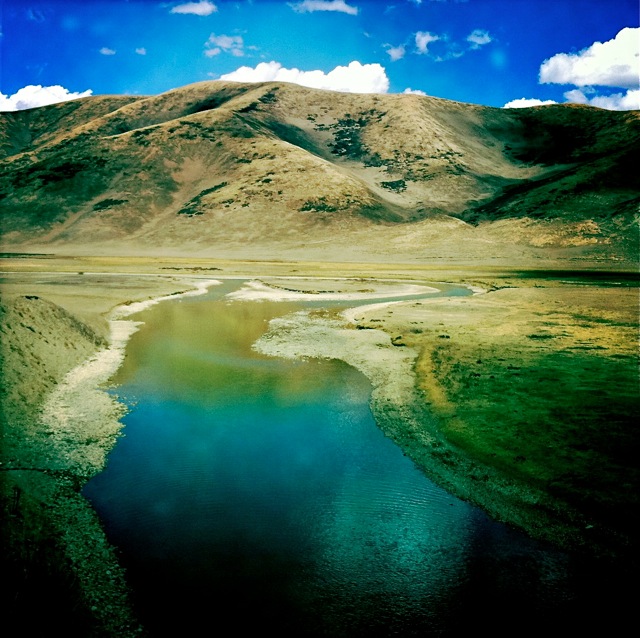
We are heading west to Mado and the famed salt lake awaits us (we think). Mado County rests at 4,300 metres and it is known for being one of the coldest counties of all of the Tibetan regions. It is called Marduk to the Tibetans meaning, “high place” and it is that, though the ‘town’ itself was more of a nomadic seasonal dwelling place wedged into a long lake shaped valley.

———-
For the full post, please visit http://www.tea-and-mountain-journals.com/
Image: Jeff Fuchs

Amne Machin – A Rush of White and a Kora

The following is an excerpt from Jeff Fuchs’ Tea and Mountain Journals, a blog by explorer, photographer and writer Jeff Fuchs.  Jeff is the 2011 recipient of AsiaTravel’s Explorer Grant.  He and friend Michael Kleinwort are currently traveling through unknown portions of the Tsalam route in Qinghai.

Below is an update from their journey…

———-

Amye Maqen (Amne Machin, Anye Machin) <http://en.wikipedia.org/wiki/Amne_Machin>, the stout, the muscular, and for much of time, the utterly hidden from the outside world…our first glimpse of it is of a snow capped wonder that appears far closer than it is. There seem to be as many ways of spelling it as their are potential descriptives. Neither wind blown sand nor a haze can obscure its brilliant bulk. It seems to hang from the sky as we come in from the northwest towards the makeshift town at its base, Xiadawu (or in the more flavoured local Tibetan ‘Da’wurr’ – ‘Place that is difficult for horses’). In Joseph Rock’s accounts of the mountain and bandit ridden regions back in 1930 he estimated the broad peaks of Amne Machin to be 30,000 feet, a guess that was later proven to be 3,000 metres off.


Amne Machin – A Rush of White and a Kora

Amne Machin from the northwest


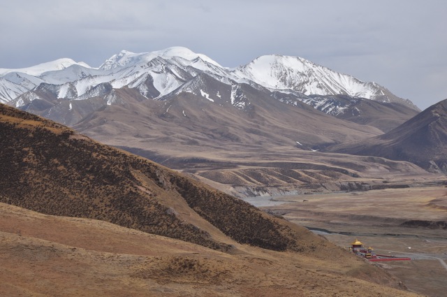
The Amne Machin range itself is an eastern extension of the greater Kunlun Mountain range, one of Asia’s longest most legend laden mountain chains. Located in the Golog Tibetan Autonomous Prefecture it is here that the Yellow River (so named because of wind-blown loess that is carried in from Central Asia) rises before winding eastward. At its rounded and almost friendly white peaks it achieves just over 6,200 metres.

Mountains cannot be compared to other of their kind in my eyes. Mountains are landscapes, heaps of stone and snow unto themselves and each has their own thin-aired identity. Sacred to the Golog (Golok) nomads, Amne Machin is almost directly due east of our pristine salt lake near Mado (Mardo) that we’ve most recently left. It also lies on the route that nomads from southwest took to access their precious salt. Few nomadic caravans would pass up the chance to visit and circumambulate the sacred Amne Machin range while undertaking a perilous journey to source salt. Ever practical, the Tibetan traders saw the value of doing both trade for a revered commodity and a little cleansing of past ills.

This mountain that has long played a role in local nomad’s worship of the divine, has withstood weathering seasons and has become more iconic in the eyes of men over time. The fact that it lies as a northwest-southeast diagonal throughway for traders only increases the curiosity for Michael and I. How much is left in memory and physicality of the salt route legacy? How much of any trade route – seldom acknowledged, documented or discussed – will survive? It is in this way that these journeys and explorations are truly ‘exploratory’ with nothing being guaranteed.

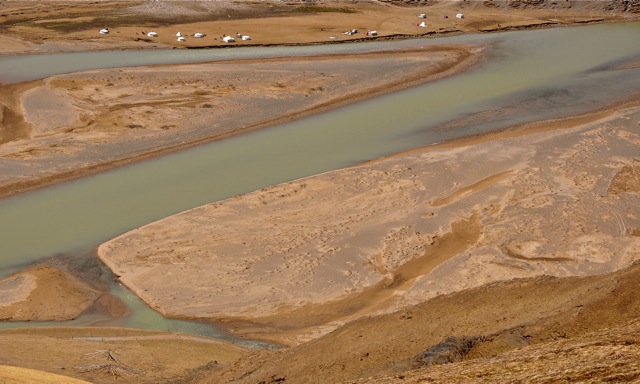
The town of Xiadawu, sits in a small cupped valley and is a dusty mess of pool tables, remarkably shabby huts and a main square of errant apathetic dogs that have forgotten their roles. Xiadawu’s decrepit appearance serves as an entry to something far greater than itself, Amne Machin, which erupts to the east. Flowing west out of the mountains past the town, the swerving breadth of the Nam Chu (Nam River) wanders through, over and around valleys in a never-ending search.

Amne Machin – A Rush of White and a Kora

Namchu (Nam River)

Our host, Tsering, is to be found out of town – it is he who will arrange our kora/ circumambulation around the great mountain. The ‘kora’ or counterclockwise circumambulation literally refers to a pilgrimage. For many eastern religions this act is believed to be a physical way to cleanse or clear away one’s past sins.

If in fact this is the case it may well take a few more than one rotation for Michael and I to wipe our collective slates clean.

Amne Machin – A Rush of White and a Kora

Around us the landscape ripples with Spring’s pending arrival – ridges verging on going from ochre to green. Still though, the high peaks remind in a glance that up here at over 4,000 metres winter isn’t really ever truly ‘over’.

Our host Tsering tells us that, yes, the salt traders came through here as part of their annual travels – more specifically nomadic traders, who, coming from further east, would add the kora of the mountain to their travels to the salt lakes. A kind of double-pronged travel plan: salt for need and profit, kora for life-cleansing benefits.

Amne Machin – A Rush of White and a Kora

———-

For the full post, please visit http://www.tea-and-mountain-journals.com/
Image: Jeff Fuchs

Saving the Secret Towers

The following is an excerpt from an article in The Wall Street Journal by Mitch Moxley, a Canadian journalist with national and international reporting experience. He’s written on politics, travel, business and other topics from China, Mongolia, Japan, Vietnam and the Philippines. He is currently based in Beijing, China.

———-

The ride from Chengdu to Danba Valley is one to be endured, not enjoyed. The journey is by a smoke-filled bus with tiny seats that barrels deep into the mountains of western Sichuan province, shaking and rattling on a single-lane road that is often strewn with fallen rocks. A hair-raising view out the window is of the Dadu River below.

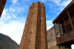
This is the route to one of China’s most enduring architectural mysteries. Ten hours and 400 kilometers into the journey, the valley opens to reveal green mountains topped with snowy peaks. On a ridge above stand a half-dozen rock towers, like ancient smokestacks.

The Secret Towers of Western China

View Slideshow

Saving the Secret Towers

James Wasserman for The Wall Street JournalOne of the many multi-faceted towers in the village of Suopuo, Danba County, Sichuan, China.


Across the remote, earthquake-prone regions of western Sichuan and Tibet, there are hundreds of these structures. They are built of cut stone, brick and timber, date back as far as 1,700 years and stand up to 50 meters tall. No one is sure of their purpose, though theories abound: They were watchtowers, way stations, status symbols. Some say they have religious meaning.

Striving to save the towers from the forces of neglect, earthquake and a planned hydropower dam are a small number of preservationists, including Frédérique Darragon, a 61-year-old global adventurer—sailor, dancer, trekker, polo player— turned amateur archaeologist by her love for these mysterious structures.

The daughter of a wealthy Parisian inventor and machine maker who died when she was 4 years old, Ms. Darragon spent childhood summers riding horses in England and winter breaks skiing in the Alps. She worked on a kibbutz in Israel and in 1971 sailed across the Atlantic in the first race from Cape Town to Rio de Janeiro. She returned to Paris, graduated from university there and then did some work as a model—”Not high fashion,” she says, “just for extra money”—played polo in Paris and Buenos Aires and became a lauded samba dancer in Rio.

During the early ’90s, Ms. Darragon spent several months a year traveling alone through China, often by foot in areas that are still rarely visited by Westerners. It once came close to killing her: In 1993, while searching for endangered snow leopards in Tibet, she suffered a stroke when a fire she built in a cave consumed too much of its oxygen supply. She lay for three days before being rescued by Tibetan shepherds.

Three years later, Ms. Darragon saw her first towers, while traveling near Danba. A year after that she saw similar towers in Tibet—800 kilometers away—and was hooked. “When I learned that neither Westerners nor Chinese had researched them and that practically nothing was known about them, I could not resist trying to crack their mystery,” Ms. Darragon says of her long affair with the ancient towers.

The Danba Valley, home to ethnic Tibetan and Qiang villages, is one of the best—and most accessible—places to explore the towers. Five kilometers from Danba city (danba means “town of rocks”) a series of sprawling villages collectively called Suopo has about 80, some in ruins but many still standing, and some of them more than 30 meters high.

Until recently, nobody knew the towers’ age with any real degree of certainty. There are references in texts from the Han Dynasty, which lasted for about 400 years starting in 206 B.C., but the peoples who historically populated the tribal corridor of Sichuan and Tibet lacked a written language, so there was no documentary evidence of the towers’ origin. Chinese archeologists had taken scant interest in the riddle.

Saving the Secret Towers

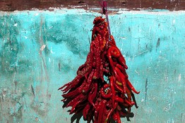
James Wasserman for The Wall Street JournalChiles hang outside a window in Danba County.

It was a linguist who wrote one of the first papers on the subject, in 1989. Sun Hongkai, now retired from the Chinese Academy of Social Sciences, had first seen the towers during a 1956 visit to Sichuan to investigate the Qiang language. “People in the area did not pay attention to the towers,” Mr. Sun says. “Many were destroyed during the Cultural Revolution. People used the stones for building materials.”

In the 15 years since Ms. Darragon was drawn to the mystery, she has devoted much of her life to cataloging, dating and fighting to preserve hundreds of the enigmatic stone skyscrapers.

In 2001, with funding from U.S. media mogul Ted Turner, a fellow sailing enthusiast she’s known for decades, she created the nonprofit Unicorn Foundation, dedicated to education and humanitarian projects.

“I’m very proud of Frederique and the work she’s done in China,” Mr. Turner says. “Her amazing discoveries are astounding, and her commitment and dedication to the preservation of some of China’s great artifacts and structures will always be admired and respected.”

————

To read the full article, click here. To inquire about journeys to see these towers in Sichuan, please e-mail info@wildchina.com.

Amne Machin White and A Travelling Circus

The following is an excerpt from Jeff Fuchs’ Tea and Mountain Journals, a blog by explorer, photographer and writer Jeff Fuchs.  Jeff is the 2011 recipient of AsiaTravel’s Explorer Grant.  He and friend Michael Kleinwort are currently traveling through unknown portions of the Tsalam route in Qinghai.

Below is an update from their journey…

———-
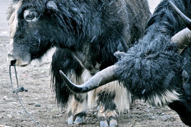
Our two yak stand still in the blowing white snow; around them there is nothing to suggest a specific time-period and looking at their ice-encrusted wool I imagine a time long ago when gas-spewing, noise machines on wheels hadn’t yet taken over – where movement on land required the foot or hoof. Here, now, in this blowing snow beneath a mountain it is remarkably easy to imagine this time.
Amne Machin White and A Travelling Circus

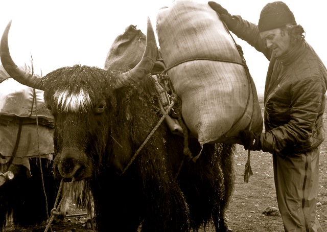
The yak stand before us resigned and powerful, and it is evident that it is in their DNA and memory banks to wait, to be loaded and to traipse where few beings can. Mobile, tough and silent they provide the broad backs for transport. Nomads delight in riding horses but in these parts no other ‘transporter’ can predictably claim the reliability title at altitude as can these behemoths.

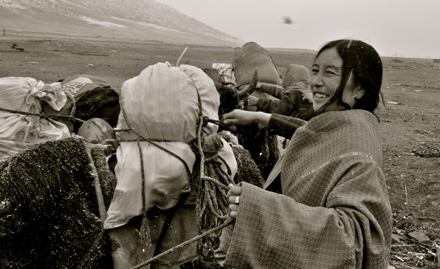
Apart from the yak, all things seem in rapid motion. Snow is contorting and rushing at us from above. The headwoman of the village is continuing to issue orders, while simultaneously tightening up yak wool cords around our gear.

Amne Machin White and A Travelling Circus

Ancient and essential, the art of loading and tying gear to mules or yak’s backs is something that has long been prized and traders often picked their muleteers or ‘yak-men’ based on their abilities in this skill. Our guide Neema, a short and slight man whose face wouldn’t be at all out of place in the Andes of South America is organizing our food and necessities into bigger bags that will also be tied onto the back and flanks of our yak. One item, an essential given the time of year is a double reinforced bag of dried yak dung patties – fuel for our life giving fires. We are above the treeline here at almost 4 km’s in the sky and the areas where we will tread will not yet have herds of yak…nor their vital ‘droppings’ for us to use.
Amne Machin White and A Travelling Circus

Huge flakes of snow explode into moisture as they pop against our jackets, and the mountains around us (that we can make out) are already building up their coats of white. The snow is unrelenting and it is hard to imagine a world without white. The winds are crafty, coming at us from all angles at once it seems.

Making our way out of the valley our vistas open up, but not our sightlines. They are paralyzed by drapes of white snow. Our contingent of moving bodies has somehow become eight bodies. The two yak seem to know precisely where they are going silently leading the way. Neema has mounted a chestnut pony – a lanky tough looking creature, and two dogs have joined along. One dog, a beige 10 kg livewire of energy looks part terrier and part fox, carrying a small diagonal scar on his snout which gives him the look of a seasoned street fighter.

The second dog, a Tibetan mastiff carries his black bulk easily and has the most forlorn brown eyes I have seen in a long while. Michael is wrapped in a black hood and I am encased for the wind and snow. Snow, as it does has at once darkened the entire day and made it so bright that we need the sunglasses for the glare.

Squeezing through a last bottleneck of space, we make out a hazy outline coming up to our left. Unseen to our right, down a plunging valley is the Nam River and the structure to our left, which clarifies as we approach, is the Ge Re Monastery, a new monastery that reminds me strangely of a mosque in shape. It sits as sort of a gateway into a bigger world beyond. It is still in the onslaught of snow…everything but the snow now seems still.

Amne Machin White and A Travelling Circus

———
For the full post, please visit http://www.tea-and-mountain-journals.com/
Image: Jeff Fuchs

It’s Pu-erhfectly healthy and delicious

It’s Pu-erhfectly healthy and delicious

A disk of compressed Pu-erh tea for sale at a tea market in Yunnan

It’s not often that one encounters a tourist souvenir that lowers cholesterol, promotes weight loss and protects against cancer, vascular disease, cognitive degeneration and aging – not to mention providing important nutrients like amino acids.

But tea is believed to have these virtues and recent research shows that certain types of Pu-erh tea from China’s Yunnan province have particularly potent levels of beneficial chemical compounds.

AsiaTravel visits Pu-erh production areas in Yunnan on its trip ‘The Ancient Tea & Horse Caravan Road: An Expedition with Jeff Fuchs.’ Learning about the fascinating history of the ancient trade routes along which Pu-erh tea once traveled by horseback to Tibet is a highlight of many clients’ trips.

Another highlight is trekking in Yunnan through tea agro-forests and wild tea gardens where members of exotic ethnic minorities like the Bulang, Lahu and Akha have tended organic tea gardens for generations in the general area from which tea is believed to have first emerged.

In fact, it is believed to be these small-scale, natural growing practices which impart the best Pu-erh tea with heightened health benefits. Most tea in the world these days is produced in sprawling plantations, planted in neat rows in direct sunlight and often treated with chemical fertilizers, pesticides and other agricultural chemicals.

Not so with the finest Yunnan Pu-erh tea. To start with, it is not all produced from a genetically uniform crop. As we learned recently from the excellent book Tea Horse Road, Pu-erh is produced from a dozen wild cousins and hundreds of landraces of the Camellia sinensis plant – each particularly adapted to the climate of the particular hillside, or even grove, where it has traditionally been grown.

And instead of being grown in a tea monoculture, these trees (many reach an age of a few hundred years and a height of 50 or more feet) grow shaded from harsh sunlight in a natural ecosystem with hundreds of other plant, animal and insect species.

Thriving in their natural environment, agro-forest and tea garden trees produce higher levels of the beneficial compounds that first drew humans to start drinking tea, likely as a medical elixir, some three thousand or more years ago.

A study published last year in the Journal of Ethnopharmacology¹ compared Pu-erh from both terrace plantations and ecologically friendly agro-forests, measuring levels of tea catechins, flavonoid compounds that are thought to be beneficial to human health and are present to varying degrees in most non-herbal tea. The authors found that tea from the agro-forests had average catechin levels several times higher than the plantation tea.

So if you find yourself in southern Yunnan, relaxing after a day of trekking through ancient tea gardens and sipping on a cup of Pu-erh, you can feel good about the fact that a hike isn’t the only good thing you’re doing for your health that day. And don’t forget that a compressed cake packs great for the trip home.

1: See: Ahmed, et al “Pu-erh tea tasting in Yunnan, China: Correlation of drinkers’ perceptions to phytochemistry”, Journal of Ethnopharmacology 132 (2010) 176–185

Tsalam – The Ancient Salt Route

The following is an introduction to Jeff Fuchs’ Tea and Mountain Journals, a blog by explorer, photographer and writer Jeff Fuchs.  Jeff is the 2011 recipient of AsiaTravel’s Explorer Grant.  He and friend Michael Kleinwort are currently traveling through unknown portions of the Tsalam route in Qinghai.

Below is an announcement about their journey…

———-

The Route of White Gold


When: May, 2011

Who: Jeff Fuchs, Michael Kleinwort

Where: Southern Qinghai (Amdo)

One of the ancient world’s great and unheralded trade routes was the eastern Himalayas’ Tsalam, or Salt Road. Known to many Tibetans as “The route of white gold”, much of its desiccated remains rest at close to 4 km in the sky upon the eastern Himalayan Plateau.

Traversing some of the planet’s most remote and daunting terrain, the Tsalam passed through the snowy homeland of the fierce Golok nomads, notorious wolf packs and beneath the sacred Amye Maqen mountain range of southern Qinghai province (Amdo). Largely forgotten it remains culturally, historically and geographically one of the least documented portions on earth. The memories of a few traders carry on its almost fabled tale.

The route itself has never before been acknowledged (nor travelled) by westerners, and much like the Tea Horse Road, the last remaining traders who traveled its length are passing away and with them too, the memories of what for many was the only access path into the daunting nomadic lands.


Leading the expedition and transcribing the tale of Tsalam will be myself, with English entrepreneur and endurance athlete Michael Kleinwort joining me. Along with local nomadic guides and the odd mule, our “0 carbon footprint team” will attempt to travel the most isolated and unknown portion of the route – a remote nomadic portion from Honkor to the Maqu area.

The expedition in May of 2011 will be done entirely by foot and will access many of the last nomadic traders to document their precious recollections of travel along the Tsalam. The expedition is another of the ancient Himalayan trade routes I hope to re-expose to some light. Articles in select publications will appear upon completion of the journey.

Tsalam – The Ancient Salt Route

Jeff Fuchs

Tsalam – The Ancient Salt Route

Lubden & Michael Kleinwort

———-

For more, please visit http://www.tea-and-mountain-journals.com/
Image: Jeff Fuchs

Snapshot from the road: Time travel in the Nu Valley

Snapshot from the road: Time travel in the Nu Valley

Sometimes when on the road, the past and present can collide in the most unexpected of places. We were reminded of this recently when on the road in the lush upper reaches of the Salween River in Yunnan, where the river is known as the Nu River.

It was a Sunday morning and we’d been enjoying the Tibetan-style Buddhist architecture in hills near the remote town of Bingzhongluo. The fresh, invigorating air filled our lungs as we headed down into the valley, where we came upon a rebuilt Catholic church that had originally been constructed more than a century ago.

It was half past ten and mass was going to start at eleven. A small crowd of worshippers from the Lisu ethnic group was waiting to enter the building. We walked around to one side of the church where we came upon a small graveyard with only one headstone.

Upon closer inspection, we made out the name of the deceased: “Annet Genestier”. The name rang a bell instantly, as just one night earlier we had  re-read some of famed botanist/explorer Joseph Rock’s impressions of traveling through the Nu Valley, which were published in an article in National Geographic from August, 1926 entitled “Through The Great River Trenches of Asia”.

Snapshot from the road: Time travel in the Nu Valley

In the article, Rock described the animosity between local Tibetan lamas and a French church and mission, led by a stubborn priest surnamed Genestier.

Relating what back then was recent history of the mission, Rock wrote:

“Twice it has been burned by the Tibetan lamas of Champutong, and twice intrepid Father Genestier, who still lives in the Salwin Valley… had to flee for his life and find shelter among the Lissu further south.”

In 1937, Pêre Genestier died and was buried in this remote spot far from his native France. Standing deep in the mist-filled Nu Valley, we scanned our surroundings. It was hard not to feel that Genestier had stood in the same place nearly a century ago and seen almost the exact same scene that laid before us.

Whenever we travel, we do our best to read, or re-read, books or other materials about the places we plan on visiting. This not only gets us even more excited about our upcoming destinations, but small, almost negligible information such as the last name of a priest can suddenly make a connection that spans decades or even centuries.

These kinds of connections are at the heart of the importance of travel to our understanding of who we are and where we’ve come from.

———

For more information about this remote and still unknown region, also check out the film Deep in the Clouds by Liu Jie, winner of the Sydney Chinese Film Festival for Best Director. Also, travel to this destination on our AsiaTravel journey From the Salween to the Mekong: Hiking the 19th Century French Explorers’ Route.

Snapshot from the road: an unexpected World War II memorial

Snapshot from the road: an unexpected World War II memorial

The reconstructed wreckage of an American C-53 transport plane on display in Pianma, Yunnan

The C-53 Skytrooper’s battered fuselage is incongruous here in the small town of Pianma in one of China’s most remote corners. The transport aircraft is a relic of one of the Second World War’s most overlooked chapters – The Hump airlift.

Far from the ferocious battles in the Pacific, Allied forces were also waging a heroic and strategically vital campaign in the early 1940s to stop China from falling to Japanese forces. One part of this campaign was the team of rough-and-tumble fighter pilots of the Flying Tigers volunteer group and subsequent Air Force fighter pilot squadrons that achieved success against enemy fighters and bombers by using innovative tactics to make up for inferior equipment.
Snapshot from the road: an unexpected World War II memorial

World War II memorabilia on display in Pianma

But equally important was the 42-month airlift over the spine of the Himalayan Mountains that kept Allied forces in China supplied after Japanese forces cut off the Burma Road, a vital overland supply route. The route from northern India to air bases across southwest China is known as “The Hump,” after the nickname that pilots gave to the high mountain ranges that it passed over.
The Hump airlift, which began in 1942, is estimated to have delivered 650,000 tons of cargo, including drums of precious aviation fuel for Allied fighter planes based in Kunming, Baoshan and other hastily-constructed airfields across Yunnan. The legacy of this effort lives on today: AsiaTravel clients visiting Yunnan via provincial capital Kunming’s Wujiaba Airport are actually landing at a former World War II airstrip.
The resupply missions were operated by the China National Aviation Corporation (CNAC) with heavy support from the United States. CNAC was a branch of China’s embattled Kuomintang government, which was fighting a multi-front war against Japanese forces and had largely retreated to Sichuan and Yunnan in southwest China.
Supplies had to get through to China regardless of weather conditions, which added another layer of danger to the risky business of flying heavily-laden propellor planes over high Himalayan passes. The plane we are looking at now in Pianma was one of the airlift’s many casualties.
Snapshot from the road: an unexpected World War II memorial

Part of Gaoligong mountain range above Pianma

Pianma is along Yunnan’s western border with Myanmar. The town is situated in an extremely remote area on the western slopes of the Gaoligong mountain range. The jungles and mountains surrounding it are lonely and hauntingly beautiful. It is near here that an American pilot named Jimmy Fox and his two Chinese crew members crashed on 11 March 1943 while making the return flight to India from Kunming.
The C-53’s wreckage was discovered near Pianma by a hunter in 1996. Local people then reconstructed it and housed it in the memorial hall in which we are now standing, which was built with assistance from American donors. The reconstruction consists only of a shell with no wiring or instruments, and it is missing half a wing. There are parts of two engines and a wheel on display as well, and a collection of photos, books and other Hump and Flying Tigers memorabilia.

Snapshot from the road: an unexpected World War II memorial

Pianma is about the last place one expects to find a World War II museum, but as we have also noted recently while visiting Christian churches in the nearby Nu River valley near the Tibetan border, travel has the capacity to reveal remarkable collisions of past and present.
If you’re interested in China’s fascinating World War II history, consider our journey, “The Flying Tigers Route – 60 Years On,” or contact us today to let us craft a custom China experience that visits Pianma and other great spots the country.
————

Discover the unexpected with AsiaTravel. Contact us to start planning your journey: info@wildchina.com

AsiaTravel Explorer Grant provides adventurers the opportunity to turn their outdoor visions into real advancements in China exploration

AsiaTravel would now like to offer adventurers the opportunity to turn their outdoor visions into real advancements in China exploration through The AsiaTravel Explorer Grant.

The AsiaTravel Explorer Grant is a grant of USD 1,000 that will be awarded to adventurers seeking to push the boundaries of responsible, off-the-beaten-path travel in China.

AsiaTravel’s own story is one of exploration, self-discovery and challenge.  High up on the slopes of Tibet’s Mount Kailash, Mei braved the high altitudes and harsh landscapes to find true beauty of snowcapped mountains alight with the sunrise. The breathtaking view brought Mei a sense of fulfillment—yet she stood alone and exhausted from her journey. Disappointed by how little support was available for travelers looking to get off the beaten path in China, Mei was inspired to start her own travel company dedicated to offering stress-free and responsible travel to adventurous destinations.  The creation of the AsiaTravel Explorer Grant is a testament to supporting other explorers in finding authentic and life-changing travel experiences while protecting local cultures and environments.

AsiaTravel Explorer Grant provides adventurers the opportunity to turn their outdoor visions into real advancements in China exploration

In its initial year, the AsiaTravel Explorer’s Grant has been granted to Canadian explorer and writer Jeff Fuchs, with British entrepreneur and endurance athlete Michael Kleinwort joining him.  Along with local nomadic guides and the odd mule Fuchs and Kleinwort will attempt to travel the most isolated and unknown portion of the Tsalam route in Qinghai – a remote portion from Honkor to the Maqu area. The expedition in May of 2011 will be done entirely by foot leaving as little carbon footprint as possible. It will also access many of the last nomadic traders to document their precious recollections of travel along the Tsalam. The expedition is another in Fuchs’ desire to bring Asia’s long lost trade routes to light.

Looking to the future, AsiaTravel will be selecting winners based on the following criteria:

  • Focus on bringing to light a long lost route, a culturally significant issue, promoting aid in a remote community or a trip dealing with discovery or rediscovery
  • Passion and excitement for exploration
  • Past/current involvement with exploration in China
  • Risk management plan
  • Incorporation of Leave No Trace (LNT) principles
  • Low carbon travel
  • Participant skill levels commensurate with proposed itinerary.

For more information, please e-mail us at explorergrant@wildchina.com.